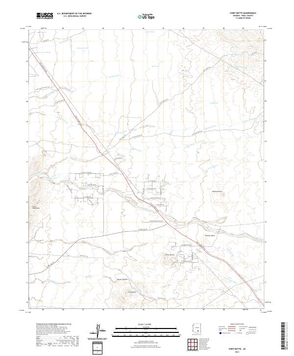
2021 Map of Chief Butte
USGS Topo · Published 2021About this map
Chief Butte and the surrounding desert landscape of Pinal County are defined by a complex network of drainage systems and isolated peaks. The Pinal Pioneer Pkwy serves as the primary corridor through this arid terrain, bisecting the land as it travels northwest past Panther Butte and the Three Buttes. These landforms, along with Antelope Peak, rise sharply from the basin floor, providing critical landmarks in a region dominated by ephemeral watercourses like Coronado Wash and Suffering Wash.
Find a feature on this map
55 named features on this map. Tap any name to fly to it.
Don’t see what you’re looking for? This feature index may not catch every label — zoom into the map to look around manually.
Map Details
Editions of this 2021 Chief Butte Map
This is the sole edition of this map. No revisions or reprints were ever made.
Other maps of this area

1911 · Winkelman
USGS Topo · 1:125,000

1913 · Winkelman
USGS Topo · 1:125,000

1934 · Newman Peak
USGS Topo · 1:125,000

1949 · Winkelman
USGS Topo · 1:62,500

1949 · Black Mountain
USGS Topo · 1:24,000
1950 · Black Mountain
USGS Topo · 1:24,000
1951 · Winkelman
USGS Topo · 1:62,500

1956 · Tucson
USGS Topo · 1:250,000

1958 · Tucson
USGS Topo · 1:250,000

1959 · Tucson
USGS Topo · 1:250,000