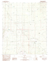
1988 Map of Chief Butte
USGS Topo · Published 1989About this map
The Tortolita Mountains rise along the western edge of this desert landscape, defined by a complex drainage system including Bogard Wash and Durham Wash. In the late 1980s, the area reflects a history of small-scale resource extraction and remote water management. Industrial activity is marked by the Bogard Open Pit Mine in the north and the Big Mine near Parker Canyon, while the presence of a Mine Well and Mine Shaft suggest subsurface prospecting.
Find a feature on this map
38 named features on this map. Tap any name to fly to it.
Don’t see what you’re looking for? This feature index may not catch every label — zoom into the map to look around manually.
Map Details
Editions of this 1988 Chief Butte Map
This is the sole edition of this map. No revisions or reprints were ever made.
Other maps of this area

1911 · Winkelman
USGS Topo · 1:125,000

1913 · Winkelman
USGS Topo · 1:125,000

1934 · Newman Peak
USGS Topo · 1:125,000

1949 · Winkelman
USGS Topo · 1:62,500

1949 · Black Mountain
USGS Topo · 1:24,000
1950 · Black Mountain
USGS Topo · 1:24,000
1951 · Winkelman
USGS Topo · 1:62,500

1956 · Tucson
USGS Topo · 1:250,000

1958 · Tucson
USGS Topo · 1:250,000

1959 · Tucson
USGS Topo · 1:250,000