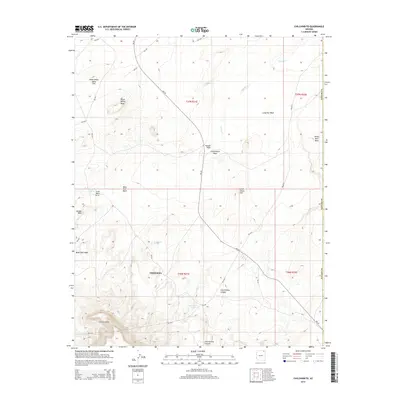
2014 Map of Chilchinbito
USGS Topo · Published 2014About this map
Chilchinbito serves as the central hub of this high-desert landscape in Navajo County, where the network of Bureau of Indian Affairs roads, such as Bia-59, traces the natural contours of the land. The settlement is positioned near essential water sources like Chilchinbito Spring, reflecting the historical importance of springs in this arid environment. The geography is defined by prominent high points and mesas, including the broad Small White Mesa to the northwest and the sharp overlook of Crevice Point to the southwest.
Find a feature on this map
29 named features on this map. Tap any name to fly to it.
Don’t see what you’re looking for? This feature index may not catch every label — zoom into the map to look around manually.
Map Details
Editions of this 2014 Chilchinbito Map
This is the sole edition of this map. No revisions or reprints were ever made.
Other maps of this area

1883 · Marsh Pass
USGS Topo · 1:250,000

1892 · Marsh Pass
USGS Topo · 1:250,000

1892 · Canyon De Chelly
USGS Topo · 1:250,000

1954 · Shiprock
USGS Topo · 1:250,000

1956 · Marble Canyon
USGS Topo · 1:250,000

1958 · Shiprock
USGS Topo · 1:250,000

1959 · Shiprock
USGS Topo · 1:250,000

1959 · Marble Canyon
USGS Topo · 1:250,000

1961 · Marble Canyon
USGS Topo · 1:250,000
1968 · Kayenta East
USGS Topo · 1:24,000