1968 Map of Kayenta East
USGS Topo · Published 1971About this map
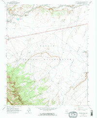
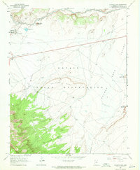
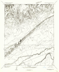
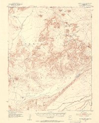
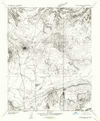
Kayenta serves as the primary hub in this late 1960s study of the high desert landscape within the Navajo Indian Reservation. The mapping documents a period of civic infrastructure growth, noting the Monument Valley High Sch, a local Cem, and Sewage Disposal Ponds near the northern banks of Laguna Creek. The topography is dominated by striking geological formations, most notably the towering Church Rock and the extensive Hallburn Ridge that bisects the central terrain.
Find a feature on this map
20 named features on this map. Tap any name to fly to it.
Don’t see what you’re looking for? This feature index may not catch every label — zoom into the map to look around manually.
Map Details
Editions of this 1968 Kayenta East Map
2 editions found
Other maps of this area

1883 · Marsh Pass
USGS Topo · 1:250,000

1892 · Marsh Pass
USGS Topo · 1:250,000
1952 · Boot Mesa
USGS Topo · 1:62,500
1952 · Agathla Peak 2 SE
USGS Topo · 1:24,000
1952 · Agathla Peak 1 SE
USGS Topo · 1:24,000
1952 · Agathla Peak
USGS Topo · 1:62,500
1952 · Agathla Peak 1 SW
USGS Topo · 1:24,000

1956 · Marble Canyon
USGS Topo · 1:250,000

1959 · Marble Canyon
USGS Topo · 1:250,000

1961 · Marble Canyon
USGS Topo · 1:250,000