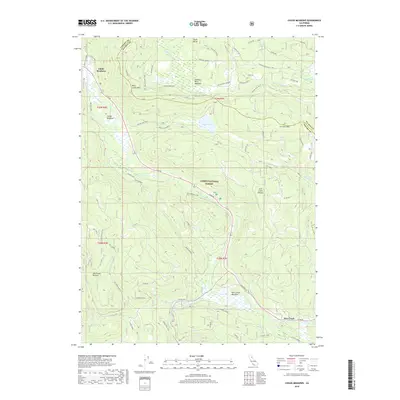
2018 Map of Childs Meadows
USGS Topo · Published 2018About this map
Lassen National Forest encompasses much of this high-elevation landscape, where the headwaters of the N Fork Feather River and Deer Creek gather from snowmelt-fed meadows. The area is defined by its seasonal wetlands and meadows, such as Childs Meadows, Feather River Meadows, and Deer Creek Meadows, which historically served as vital stopping points along trans-Sierra routes. Traces of pioneer history are preserved in the Lassen Trail and associated Historic Marker, marking the path of early emigrants through the volcanic terrain between Wild Cattle Mtn and Ice Cave Mtn. This document captures the modern road network, including the Old Red Bluff Rd (FH 169), alongside primitive routes like the Chicken Coop and S Buzzard Loop that traverse the Lost Creek Plateau.
Find a feature on this map
46 named features on this map. Tap any name to fly to it.
Don’t see what you’re looking for? This feature index may not catch every label — zoom into the map to look around manually.
Map Details
Editions of this 2018 Childs Meadows Map
This is the sole edition of this map. No revisions or reprints were ever made.
Other maps of this area

1886 · Lassen Peak
USGS Topo · 1:250,000

1892 · Lassen Peak
USGS Topo · 1:250,000

1894 · Lassen Peak
USGS Topo · 1:250,000

1935 · Paynes Creek
USGS Topo · 1:96,000

1941 · Mineral
USGS Topo · 1:125,000

1955 · Westwood
USGS Topo · 1:250,000

1956 · Lassen Peak
USGS Topo · 1:62,500

1956 · Mt. Harkness
USGS Topo · 1:62,500

1958 · Westwood
USGS Topo · 1:250,000

1958 · Jonesville
USGS Topo · 1:62,500