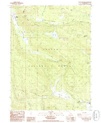
1985 Map of Childs Meadows
USGS Topo · Published 1985About this map
Childs Meadows serves as a central landmark in this high-elevation landscape where the Tehama Co Plumas Co border cuts through the northern timberlands. The terrain is defined by its complex hydrology, with the North Arm and South Arm feeding into Rice Creek, while Wilson Lake sits tucked between the slopes of Cattle Mountain and Ice Cave Mountain. The map reveals a land utilized for both recreation and early habitation, evidenced by the Gurnsey Creek Campground and the isolated Smith Cabin near Deer Creek Meadows. Small-scale industrial activity is marked by a Borrow Pit and Gravel Pit, while a Telephone Cable corridor suggests the early infrastructure traversing the Lassen Lost Creek National Forest. Notable geographic curiosities like the Ice Cave and Fire Mountain provide specific points of interest for those studying the volcanic and geological character of this part of Northern California.
Find a feature on this map
41 named features on this map. Tap any name to fly to it.
Don’t see what you’re looking for? This feature index may not catch every label — zoom into the map to look around manually.
Map Details
Editions of this 1985 Childs Meadows Map
This is the sole edition of this map. No revisions or reprints were ever made.
Other maps of this area

1886 · Lassen Peak
USGS Topo · 1:250,000

1892 · Lassen Peak
USGS Topo · 1:250,000

1894 · Lassen Peak
USGS Topo · 1:250,000

1935 · Paynes Creek
USGS Topo · 1:96,000

1941 · Mineral
USGS Topo · 1:125,000

1955 · Westwood
USGS Topo · 1:250,000

1956 · Lassen Peak
USGS Topo · 1:62,500

1956 · Mt. Harkness
USGS Topo · 1:62,500

1958 · Westwood
USGS Topo · 1:250,000

1958 · Jonesville
USGS Topo · 1:62,500