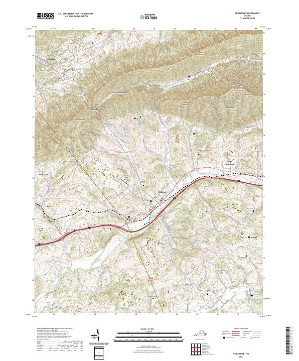
2023 Map of Chilhowie
USGS Topo · Published 2023About this map
Chilhowie serves as the central hub of this modern survey, where the Norfolk Southern rail line and Interstate 81 parallel the Middle Fork Holston River. The landscape is defined by the significant elevation of Walker Mountain to the north and the deep agricultural valleys of Cleghorn Valley and Rich Valley. Genealogists will find a high density of family and community burial sites across the Smyth County countryside, including the Sulphur Spring Cem, Kelly Chapel Cem, and Aspenvale Cem. The transition from the river valley into the foothills of Brushy Mountain reveals a network of rural routes such as Kelly Chapel Rd and Needmore Rd. This documentation preserves the modern footprint of historical settlements like Seven Mile Ford and Adwolf, alongside landmarks like the White Oak Stand Airport, illustrating the continued intersection of mountain geography and essential transport corridors.
Find a feature on this map
132 named features on this map. Tap any name to fly to it.
Don’t see what you’re looking for? This feature index may not catch every label — zoom into the map to look around manually.
Map Details
Editions of this 2023 Chilhowie Map
This is the sole edition of this map. No revisions or reprints were ever made.
Other maps of this area

1891 · Abingdon
USGS Topo · 1:125,000

1894 · Abingdon
USGS Topo · 1:125,000

1909 · Abingdon
USGS Topo · 1:96,000

1911 · Abingdon
USGS Topo · 1:125,000
1934 · Chatham Hill
USGS Topo · 1:24,000

1935 · Konnarock
USGS Topo · 1:24,000

1935 · Chilhowie
USGS Topo · 1:24,000
1935 · Maccrady
USGS Topo · 1:24,000

1935 · Mount Rogers
USGS Topo · 1:48,000
1935 · Saltville
USGS Topo · 1:24,000