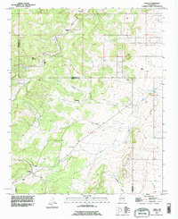
1991 Map of Chilili
USGS Topo · Published 1996About this map
The Chilili Grant area of New Mexico's Manzano Mountains foothills is defined by historical land divisions and seasonal watercourses. Centered around the settlement of Chilili, the map reveals the proximity of Old Chilili near the winding Arroyo de Chilili. The landscape is a network of arroyos and canyons, including Arroyo de Yrisarri and Arroyo de Escabosa, which carve through the high-elevation terrain towards the Grant Boundary.
Find a feature on this map
30 named features on this map. Tap any name to fly to it.
Don’t see what you’re looking for? This feature index may not catch every label — zoom into the map to look around manually.
Map Details
Editions of this 1991 Chilili Map
This is the sole edition of this map. No revisions or reprints were ever made.
Other maps of this area

1892 · San Pedro
USGS Topo · 1:125,000

1917 · Estancia
USGS Topo · 1:125,000

1954 · Chilili
USGS Topo · 1:24,000

1954 · Sedillo
USGS Topo · 1:24,000

1954 · Tajique
USGS Topo · 1:24,000

1954 · Escabosa
USGS Topo · 1:24,000

1954 · Edgewood
USGS Topo · 1:24,000

1954 · Milbourn Ranch
USGS Topo · 1:24,000

1954 · Socorro
USGS Topo · 1:250,000

1956 · Edgewood
USGS Topo · 1:62,500