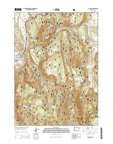
2014 Map of Chiloquin
USGS Topo · Published 2014About this map
Chiloquin sits at the confluence of two major waterways, where the Sprague River meets the Williamson River in a landscape defined by volcanic geology and timber resources. The settlement is positioned near the notable Chiloquin Narrows and Chiloquin Rapids, natural features that have historically influenced transit and industry in this part of Oregon. To the east, the terrain rises sharply toward Cave Mtn and the Canby Mountains, much of which is protected within the Winema National Forest. Local infrastructure is represented by the Modoc Point Main Canal and several water management sites like Rocky Hole Reservoir and Lobert Draw Reservoir. Genealogical interest is centered on the Friendship Cem located just east of the town center, while the grid of residential streets such as W Chocktoot St and N Lalo Ave shows the community's mid-century footprint.
Find a feature on this map
67 named features on this map. Tap any name to fly to it.
Don’t see what you’re looking for? This feature index may not catch every label — zoom into the map to look around manually.
Map Details
Editions of this 2014 Chiloquin Map
This is the sole edition of this map. No revisions or reprints were ever made.
Other maps of this area

1889 · Klamath
USGS Topo · 1:250,000

1894 · Klamath
USGS Topo · 1:250,000

1955 · Klamath Falls
USGS Topo · 1:250,000

1956 · Calimus Butte
USGS Topo · 1:62,500

1957 · Chiloquin
USGS Topo · 1:62,500

1957 · Swan Lake
USGS Topo · 1:62,500

1957 · Modoc Point
USGS Topo · 1:62,500

1958 · Klamath Falls
USGS Topo · 1:250,000

1980 · Williamson River
USGS Topo · 1:100,000
1985 · Shoalwater Bay
USGS Topo · 1:24,000