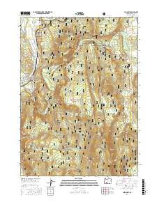
2017 Map of Chiloquin
USGS Topo · Published 2017About this map
The confluence of the Sprague River and Williamson River defines the landscape surrounding the town of Chiloquin. This 2017 survey shows the intricate water network essential to the region, including the Chiloquin Rapids and the Chiloquin Narrows. The terrain is dominated by significant elevations such as Cave Mtn and the Canby Mountains, set within the protected boundaries of the Winema National Forest. Local history is anchored by sites like the Friendship Cem, while the modern infrastructure is visible through the grid of roads such as Sprague River Rd and Williamson River Rd. The map also details water management features like the Modoc Point Main Canal and Lobert Draw Reservoir, illustrating the geographic transition between river valleys and the high Chiloquin Ridge.
Find a feature on this map
55 named features on this map. Tap any name to fly to it.
Don’t see what you’re looking for? This feature index may not catch every label — zoom into the map to look around manually.
Map Details
Editions of this 2017 Chiloquin Map
This is the sole edition of this map. No revisions or reprints were ever made.
Other maps of this area

1889 · Klamath
USGS Topo · 1:250,000

1894 · Klamath
USGS Topo · 1:250,000

1955 · Klamath Falls
USGS Topo · 1:250,000

1956 · Calimus Butte
USGS Topo · 1:62,500

1957 · Chiloquin
USGS Topo · 1:62,500

1957 · Swan Lake
USGS Topo · 1:62,500

1957 · Modoc Point
USGS Topo · 1:62,500

1958 · Klamath Falls
USGS Topo · 1:250,000

1980 · Williamson River
USGS Topo · 1:100,000
1985 · Shoalwater Bay
USGS Topo · 1:24,000