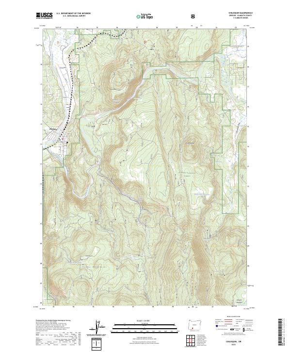
2023 Map of Chiloquin
USGS Topo · Published 2023About this map
Chiloquin serves as the focal point of this Klamath County landscape, situated at the confluence of the Williamson River and the Sprague River. The map highlights the complex water management systems of the region, including the Modoc Point Main Canal and several specialized reservoirs like the Lobert Draw-Reservoir and Rocky Hole Reservoir. These features, alongside the Chiloquin Narrows and Chiloquin Rapids, indicate a river system shaped by both natural basalt geography and human engineering for irrigation.
Find a feature on this map
36 named features on this map. Tap any name to fly to it.
Don’t see what you’re looking for? This feature index may not catch every label — zoom into the map to look around manually.
Map Details
Editions of this 2023 Chiloquin Map
This is the sole edition of this map. No revisions or reprints were ever made.
Other maps of this area

1889 · Klamath
USGS Topo · 1:250,000

1894 · Klamath
USGS Topo · 1:250,000

1955 · Klamath Falls
USGS Topo · 1:250,000

1956 · Calimus Butte
USGS Topo · 1:62,500

1957 · Chiloquin
USGS Topo · 1:62,500

1957 · Swan Lake
USGS Topo · 1:62,500

1957 · Modoc Point
USGS Topo · 1:62,500

1958 · Klamath Falls
USGS Topo · 1:250,000

1980 · Williamson River
USGS Topo · 1:100,000
1985 · Shoalwater Bay
USGS Topo · 1:24,000