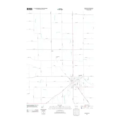
2013 Map of Chilton
USGS Topo · Published 2013About this map
The Chilton city center and the neighboring community of Gravesville dominate the southeastern quadrant of this Calumet County landscape, where the S Br Manitowoc River meets its tributaries. This 2013 survey illustrates the modern layout of the regional road network, anchored by Wi-57 and State Road 57 running north-south through the center of the sheet. Outside the urban boundaries, the terrain is defined by the winding paths of the Killsnake River and Stony Brook, with agricultural landmarks like Gruber Farm and the small settlement of Brant marking the rural intersections. The map highlights the transition between the concentrated development of the county seat and the surrounding agricultural tracts, including small-scale aviation facilities such as Flying Feathers Airport.
Find a feature on this map
75 named features on this map. Tap any name to fly to it.
Don’t see what you’re looking for? This feature index may not catch every label — zoom into the map to look around manually.
Map Details
Editions of this 2013 Chilton Map
This is the sole edition of this map. No revisions or reprints were ever made.
Other maps of this area

1910 · Fond du Lac
USGS Topo · 1:62,500

1911 · Neenah
USGS Topo · 1:62,500

1954 · Chilton
USGS Topo · 1:62,500

1954 · Kiel
USGS Topo · 1:62,500

1955 · Neenah
USGS Topo · 1:62,500

1955 · Fond Du Lac
USGS Topo · 1:62,500

1955 · Green Bay
USGS Topo · 1:250,000

1957 · Madison
USGS Topo · 1:250,000

1960 · Madison
USGS Topo · 1:250,000
1974 · Kiel
USGS Topo · 1:24,000