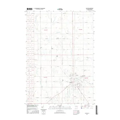
2016 Map of Chilton
USGS Topo · Published 2016About this map
Chilton serves as the primary hub in this Calumet County landscape, situated where the South Branch Manitowoc River feeds into the Chilton Millpond. The map illustrates a meticulously organized agricultural grid punctuated by smaller clusters like Brant and Gravesville. This 2016 survey documents a deep-rooted community structure through its numerous burial grounds, including the Portland Cem and Charlestown Cem, which often represent the early locations of pioneer families and long-standing parishes.
Find a feature on this map
59 named features on this map. Tap any name to fly to it.
Don’t see what you’re looking for? This feature index may not catch every label — zoom into the map to look around manually.
Map Details
Editions of this 2016 Chilton Map
This is the sole edition of this map. No revisions or reprints were ever made.
Other maps of this area

1910 · Fond du Lac
USGS Topo · 1:62,500

1911 · Neenah
USGS Topo · 1:62,500

1954 · Chilton
USGS Topo · 1:62,500

1954 · Kiel
USGS Topo · 1:62,500

1955 · Neenah
USGS Topo · 1:62,500

1955 · Fond Du Lac
USGS Topo · 1:62,500

1955 · Green Bay
USGS Topo · 1:250,000

1957 · Madison
USGS Topo · 1:250,000

1960 · Madison
USGS Topo · 1:250,000
1974 · Kiel
USGS Topo · 1:24,000