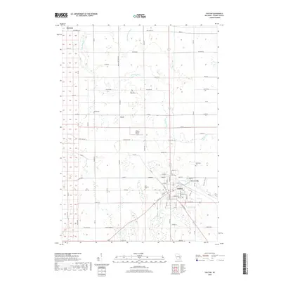
2018 Map of Chilton
USGS Topo · Published 2018About this map
Chilton and Gravesville sit at the convergence of the S Br Manitowoc River and the N Br Manitowoc River, serving as a central hub for this portion of Calumet County. The surrounding landscape is defined by an intricate network of rural roads and watercourses, including the winding path of the Killsnake River and Stony Brook. Evidence of the area's established community roots is found in the numerous historic burial grounds such as Saint Augustine Cem, Saint Luke Lutheran Cem, and the Portland Cem near the small settlement of Brant. Further north, Harrison marks the upper reaches of this agrarian corridor. The presence of the Flying Feathers Airport near the center of the quadrangle highlights the modern transport infrastructure integrated into this traditional dairy-country terrain, where section lines and local thoroughfares like Hickory Hills Rd and Co Rd BB dictate the layout of the land.
Find a feature on this map
87 named features on this map. Tap any name to fly to it.
Don’t see what you’re looking for? This feature index may not catch every label — zoom into the map to look around manually.
Map Details
Editions of this 2018 Chilton Map
This is the sole edition of this map. No revisions or reprints were ever made.
Other maps of this area

1910 · Fond du Lac
USGS Topo · 1:62,500

1911 · Neenah
USGS Topo · 1:62,500

1954 · Chilton
USGS Topo · 1:62,500

1954 · Kiel
USGS Topo · 1:62,500

1955 · Neenah
USGS Topo · 1:62,500

1955 · Fond Du Lac
USGS Topo · 1:62,500

1955 · Green Bay
USGS Topo · 1:250,000

1957 · Madison
USGS Topo · 1:250,000

1960 · Madison
USGS Topo · 1:250,000
1974 · Kiel
USGS Topo · 1:24,000