1992 Map of Chilton
USGS Topo · Published 1996About this map
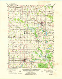
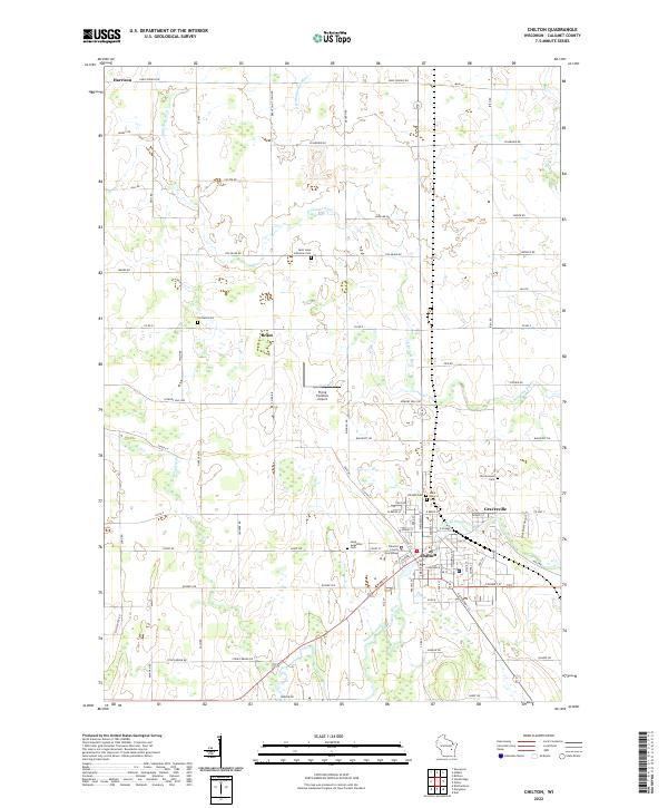
The Old Indian Treaty Boundary slices diagonally across this Calumet County landscape, serving as a silent witness to the historical partitioning of Wisconsin land. Centered on the city of Chilton, the map reveals a community deeply tied to its hydrology, where the Killsnake River and the South Branch Manitowoc River converge. The settlement pattern shows a dense network of farmstead roads like Carney Road and Hickory Hills Road connecting outlying areas such as Brant and Hayton to the central hub.
Find a feature on this map
44 named features on this map. Tap any name to fly to it.
Don’t see what you’re looking for? This feature index may not catch every label — zoom into the map to look around manually.
Map Details
Editions of this 1992 Chilton Map
This is the sole edition of this map. No revisions or reprints were ever made.
Historical Maps of Harrison Through Time
8 maps found