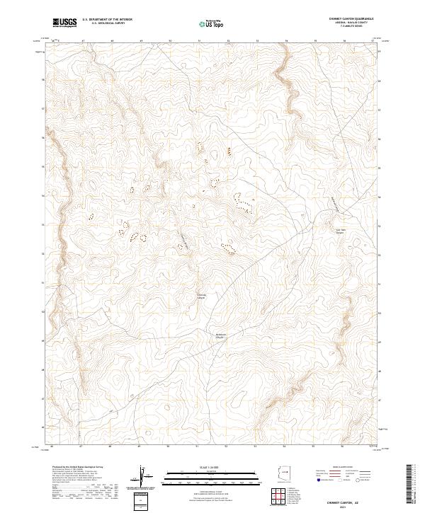
2021 Map of Chimney Canyon
USGS Topo · Published 2021About this map
Chimney Canyon and the surrounding high plateau of Navajo County are defined by a complex drainage system that feeds into larger desert basins. This 2021 survey illustrates a landscape of deep relief and ephemeral watercourses, where topographical contours reveal the erosional patterns of McDonald Canyon and Lost Tank Canyon. The area remains largely undeveloped, with human infrastructure limited to remote pathways such as Siby Rd and the label Obed, which marks a specific point of interest in this arid terrain. The map provides a precise look at the township and range divisions, including the meeting points of t17n r18e and t16n r18e, reflecting the enduring structure of the Public Land Survey System in the American Southwest.
Find a feature on this map
11 named features on this map. Tap any name to fly to it.
Don’t see what you’re looking for? This feature index may not catch every label — zoom into the map to look around manually.
Map Details
Editions of this 2021 Chimney Canyon Map
This is the sole edition of this map. No revisions or reprints were ever made.
Other maps of this area

1886 · Holbrook
USGS Topo · 1:250,000

1893 · Holbrook
USGS Topo · 1:250,000

1954 · Holbrook
USGS Topo · 1:250,000

1955 · St. Joseph 2 SE
USGS Topo · 1:24,000
1955 · St. Joseph 2 NW
USGS Topo · 1:24,000
1955 · St. Joseph 2 NE
USGS Topo · 1:24,000

1955 · Joseph City
USGS Topo · 1:62,500

1957 · Holbrook
USGS Topo · 1:250,000

1958 · Holbrook
USGS Topo · 1:250,000

1960 · Holbrook
USGS Topo · 1:250,000