
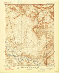
1936 Map of Chimney Rock
USGS Topo · Published 1936About this map
The San Juan River and the Chaco River converge in this high-desert landscape of the mid-1930s, documenting a critical intersection of indigenous lands and early resource development. The settlement of Ship Rock serves as a primary hub within the Navajo Indian Reservation, while the northeastern corner of the map touches the Southern Ute Indian Reservation at the Colorado-New Mexico border. This period captures the early industrial footprint of the region, including the Agency Coal Mine and a network of water management features like the Irrigation Ditch systems near the riverbanks.
Find a feature on this map
27 named features on this map. Tap any name to fly to it.
Don’t see what you’re looking for? This feature index may not catch every label — zoom into the map to look around manually.
Map Details
Editions of this 1936 Chimney Rock Map
2 editions found
Other maps of this area

1889 · Chaco
USGS Topo · 1:250,000

1892 · Chaco
USGS Topo · 1:250,000

1912 · Soda Canyon
USGS Topo · 1:62,500

1915 · Soda Canyon
USGS Topo · 1:62,500

1927 · Sulphur Spring
USGS Topo · 1:96,000

1928 · Kirtland
USGS Topo · 1:125,000

1932 · Kirtland
USGS Topo · 1:125,000

1934 · Ship Rock
USGS Topo · 1:62,500

1934 · Chimney Rock
USGS Topo · 1:62,500

1934 · Rattlesnake
USGS Topo · 1:62,500
Featured Places
- Shiprock Agency
- Shiprock, Shiprock Agency
- Hogback, Shiprock Agency
- San Juan County, NM
- Montezuma County, CO