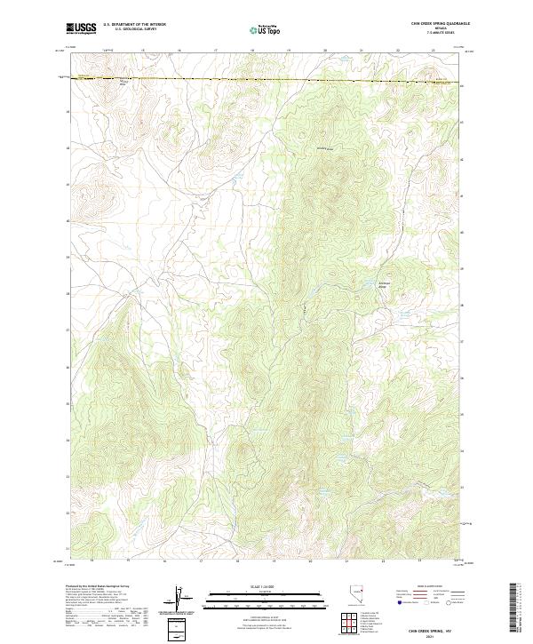
2021 Map of Chin Creek Spring
USGS Topo · Published 2021About this map
Chin Creek Spring and numerous other water sources define this arid landscape at the border of Elko and White Pine counties. The terrain is characterized by the prominent Antelope Range and the Boone Spring Hills, where natural drainages like Kinsley Draw and Antelope Wash channel seasonal runoff through the high desert. Historically significant to travelers and ranchers, these springs represent the vital water points of the Great Basin, including Stockade Springs, Lookout Springs, and Willow Patch Spring. The presence of Chin Creek Rd provides the primary access through this remote territory. These features illustrate the precarious nature of settlement and land use in eastern Nevada, where survival has always depended on specific, named watering holes such as Chokecherry Spring and North Cottonwood Spring.
Find a feature on this map
24 named features on this map. Tap any name to fly to it.
Don’t see what you’re looking for? This feature index may not catch every label — zoom into the map to look around manually.
Map Details
Editions of this 2021 Chin Creek Spring Map
This is the sole edition of this map. No revisions or reprints were ever made.
Other maps of this area

1955 · Elko
USGS Topo · 1:250,000

1956 · Ely
USGS Topo · 1:250,000

1958 · Elko
USGS Topo · 1:250,000

1959 · Ely
USGS Topo · 1:250,000

1962 · Elko
USGS Topo · 1:250,000

1963 · Ely
USGS Topo · 1:250,000

1965 · Elko
USGS Topo · 1:250,000

1979 · Sunset Reservoir
USGS Topo · 1:24,000

1982 · Chin Creek Spring
USGS Topo · 1:24,000
1982 · Kinsley Mountains
USGS Topo · 1:24,000