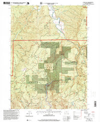
1996 Map of China Flat
USGS Topo · Published 1999About this map
China Flat sits within a landscape defined by the winding South Fork Coquille River and the high elevations of the Siskiyou National Forest. This 1996 revision documents a region of dense drainage networks and sharp topographic relief, where the Rogue-Coquille Scenic Byway follows the river corridor past Orchard Park. The map provides a detailed view of the terrain around Johnson Mountain and Sand Rock Mountain, illustrating the intersection of forest management and public recreation.
Find a feature on this map
31 named features on this map. Tap any name to fly to it.
Don’t see what you’re looking for? This feature index may not catch every label — zoom into the map to look around manually.
Map Details
Editions of this 1996 China Flat Map
This is the sole edition of this map. No revisions or reprints were ever made.
Other maps of this area

1899 · Port Orford
USGS Topo · 1:125,000

1903 · Port Orford
USGS Topo · 1:125,000

1954 · Coos Bay
USGS Topo · 1:250,000

1954 · Bone Mountain
USGS Topo · 1:62,500

1954 · Marial
USGS Topo · 1:62,500

1954 · Agness
USGS Topo · 1:62,500

1954 · Powers
USGS Topo · 1:62,500

1955 · Medford
USGS Topo · 1:250,000

1957 · Medford
USGS Topo · 1:250,000

1958 · Medford
USGS Topo · 1:250,000