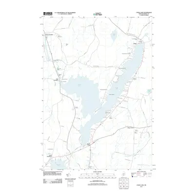
2011 Map of China Lake
USGS Topo · Published 2011About this map
China Lake dominates this Kennebec County landscape, branching into the settlements of China, South China, and East Vassalboro. The map documents a community deeply rooted in its local geography, with numerous family and community burial grounds such as Priest Hill Cemetery, Goddard Cemetery, and China Neck Cemetery marking the hillsides. The hydraulic history of the area is evident along Outlet Stream, where a series of water-control structures including Ladd Dam, Lombards Dam, Morneaus Dam, and Masses Dam supported local industry and water management.
Find a feature on this map
92 named features on this map. Tap any name to fly to it.
Don’t see what you’re looking for? This feature index may not catch every label — zoom into the map to look around manually.
Map Details
Editions of this 2011 China Lake Map
This is the sole edition of this map. No revisions or reprints were ever made.
Other maps of this area

1892 · Waterville
USGS Topo · 1:62,500

1893 · Vassalboro
USGS Topo · 1:62,500

1898 · Vassalboro
USGS Topo · 1:62,500

1916 · Liberty
USGS Topo · 1:62,500

1926 · Burnham
USGS Topo · 1:62,500

1941 · Vassalboro
USGS Topo · 1:62,500

1942 · Liberty
USGS Topo · 1:62,500

1943 · Vassalboro
USGS Topo · 1:62,500

1943 · Waterville
USGS Topo · 1:62,500

1948 · Bangor
USGS Topo · 1:250,000