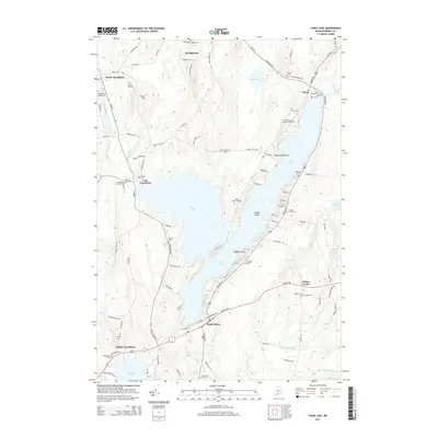
2014 Map of China Lake
USGS Topo · Published 2014About this map
China Lake dominates this central Maine landscape, branching into distinct basins and arms that define the geography of Kennebec County. The irregular shoreline is punctuated by prominent landforms such as Indian Island and Killdeer Point, while the surrounding hills like Priest Hill overlook a network of rural settlements. In the west, the flow of Outlet Stream passes through North Vassalboro, while the eastern shores host the villages of China and South China.
Find a feature on this map
102 named features on this map. Tap any name to fly to it.
Don’t see what you’re looking for? This feature index may not catch every label — zoom into the map to look around manually.
Map Details
Editions of this 2014 China Lake Map
This is the sole edition of this map. No revisions or reprints were ever made.
Other maps of this area

1892 · Waterville
USGS Topo · 1:62,500

1893 · Vassalboro
USGS Topo · 1:62,500

1898 · Vassalboro
USGS Topo · 1:62,500

1916 · Liberty
USGS Topo · 1:62,500

1926 · Burnham
USGS Topo · 1:62,500

1941 · Vassalboro
USGS Topo · 1:62,500

1942 · Liberty
USGS Topo · 1:62,500

1943 · Vassalboro
USGS Topo · 1:62,500

1943 · Waterville
USGS Topo · 1:62,500

1948 · Bangor
USGS Topo · 1:250,000