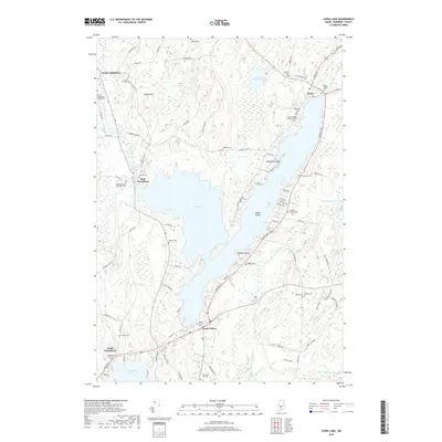
2018 Map of China Lake
USGS Topo · Published 2018About this map
China Lake dominates this Kennebec County landscape, serving as a focal point for several distinct 19th-century settlements and a remarkably high concentration of burial grounds. To the north, the village of China sits near China Village Cem, while the southern shore is home to South China and the South China Cem. On the western side, the Outlet Stream flows through North Vassalboro, East Vassalboro, and South Vassalboro, connecting these historical communities along the waterway.
Find a feature on this map
94 named features on this map. Tap any name to fly to it.
Don’t see what you’re looking for? This feature index may not catch every label — zoom into the map to look around manually.
Map Details
Editions of this 2018 China Lake Map
This is the sole edition of this map. No revisions or reprints were ever made.
Other maps of this area

1892 · Waterville
USGS Topo · 1:62,500

1893 · Vassalboro
USGS Topo · 1:62,500

1898 · Vassalboro
USGS Topo · 1:62,500

1916 · Liberty
USGS Topo · 1:62,500

1926 · Burnham
USGS Topo · 1:62,500

1941 · Vassalboro
USGS Topo · 1:62,500

1942 · Liberty
USGS Topo · 1:62,500

1943 · Vassalboro
USGS Topo · 1:62,500

1943 · Waterville
USGS Topo · 1:62,500

1948 · Bangor
USGS Topo · 1:250,000