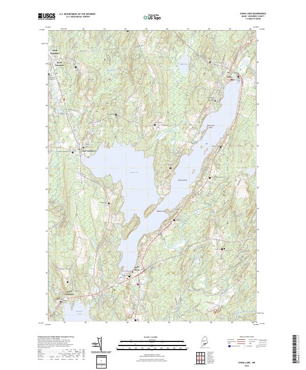
2024 Map of China Lake
USGS Topo · Published 2024About this map
China Lake dominates the central geography of this Kennebec County landscape, serving as the focal point for several distinct communities including China, East Vassalboro, and South China. The shoreline is characterized by prominent features such as Wentworth Point, Killdeer Point, and Indian Island, while the surrounding terrain rises to local heights like Priest Hill. This 2024 data highlights a deeply established rural cemetery network, ranging from the North Vassalboro Village Cem in the northwest to the South China Cem and Jones Cem near the southern basin. The settlement pattern is largely influenced by the historic road network, including the Causeway Rd and Lakeview Dr, which follow the natural contours of the lake and the Outlet Stream. Genealogists will find an unusually high density of family-named burial sites, such as the Morrell Cem, Goddard Cem, and Whitehouse Cem, providing a direct link to the region's agricultural and village heritage.
Find a feature on this map
99 named features on this map. Tap any name to fly to it.
Don’t see what you’re looking for? This feature index may not catch every label — zoom into the map to look around manually.
Map Details
Editions of this 2024 China Lake Map
This is the sole edition of this map. No revisions or reprints were ever made.
Other maps of this area

1892 · Waterville
USGS Topo · 1:62,500

1893 · Vassalboro
USGS Topo · 1:62,500

1898 · Vassalboro
USGS Topo · 1:62,500

1916 · Liberty
USGS Topo · 1:62,500

1926 · Burnham
USGS Topo · 1:62,500

1941 · Vassalboro
USGS Topo · 1:62,500

1942 · Liberty
USGS Topo · 1:62,500

1943 · Vassalboro
USGS Topo · 1:62,500

1943 · Waterville
USGS Topo · 1:62,500

1948 · Bangor
USGS Topo · 1:250,000