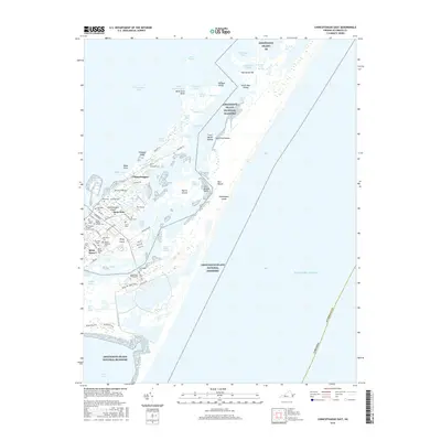
2016 Map of Chincoteague East
USGS Topo · Published 2016About this map
Chincoteague Island and the expansive marshes of the Assateague Island National Seashore dominate this coastal landscape, revealing the intricate geography of the Virginia shoreline. The town of Chincoteague is densely detailed, showing the layout of local streets such as Main St and Deep Hole Rd. The map is particularly valuable for its concentration of family and community burial grounds, including the Daisey Memorial Cem, Reynolds Cem, and Assateague Village Cem.
Find a feature on this map
88 named features on this map. Tap any name to fly to it.
Don’t see what you’re looking for? This feature index may not catch every label — zoom into the map to look around manually.
Map Details
Editions of this 2016 Chincoteague East Map
This is the sole edition of this map. No revisions or reprints were ever made.
Other maps of this area

1901 · Snow Hill
USGS Topo · 1:62,500

1901 · Green Run
USGS Topo · 1:62,500

1938 · Green Run
USGS Topo · 1:62,500

1942 · Chincoteague East
USGS Topo · 1:24,000

1942 · Wallops Island
USGS Topo · 1:24,000

1943 · Boxiron
USGS Topo · 1:31,680

1943 · Whittington Point
USGS Topo · 1:31,680

1943 · Chincoteague West
USGS Topo · 1:31,680
1943 · Girdletree
USGS Topo · 1:31,680

1943 · Wallops Island
USGS Topo · 1:31,680