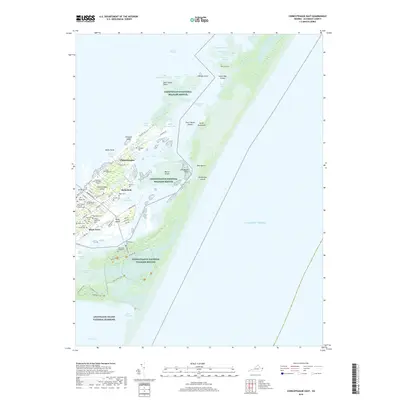
2019 Map of Chincoteague East
USGS Topo · Published 2019About this map
Chincoteague and the adjacent barrier landscape of Assateague Island appear here in a modern survey of the Virginia coast. The map reveals a high density of genealogical landmarks, including family-named sites like Birch Family Cem, Daisey Memorial Cem, and Reynolds Cem. These locations, concentrated near the historic centers of Chincoteague Island and Birch Town, provide essential points of reference for family historians and researchers tracking local lineages.
Find a feature on this map
88 named features on this map. Tap any name to fly to it.
Don’t see what you’re looking for? This feature index may not catch every label — zoom into the map to look around manually.
Map Details
Editions of this 2019 Chincoteague East Map
This is the sole edition of this map. No revisions or reprints were ever made.
Other maps of this area

1901 · Snow Hill
USGS Topo · 1:62,500

1901 · Green Run
USGS Topo · 1:62,500

1938 · Green Run
USGS Topo · 1:62,500

1942 · Chincoteague East
USGS Topo · 1:24,000

1942 · Wallops Island
USGS Topo · 1:24,000

1943 · Boxiron
USGS Topo · 1:31,680

1943 · Whittington Point
USGS Topo · 1:31,680

1943 · Chincoteague West
USGS Topo · 1:31,680
1943 · Girdletree
USGS Topo · 1:31,680

1943 · Wallops Island
USGS Topo · 1:31,680