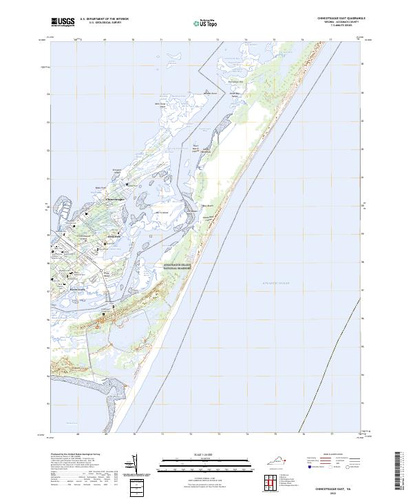
2022 Map of Chincoteague East
USGS Topo · Published 2022About this map
Chincoteague island and the surrounding salt marshes of the Virginia coast are preserved here in high detail, showing the complex boundary between the town and the Chincoteague National Wildlife Refuge. The landscape is defined by its maritime heritage and genealogy, with numerous small family and community burial grounds like Birch Family Cem, Daisey Memorial Cem, and the Whealton-Clayville Cem dotting the residential areas. To the east, the Assateague Island National Seashore buffers the Atlantic Ocean, separated from the mainland settlements of Birch Town and Deep Hole by the Assateague Channel. This map captures a modern view of a region defined by its dynamic waterways, from the expansive Toms Cove to the intricate networks of Coards Marshes and Wildcat Marsh.
Find a feature on this map
106 named features on this map. Tap any name to fly to it.
Don’t see what you’re looking for? This feature index may not catch every label — zoom into the map to look around manually.
Map Details
Editions of this 2022 Chincoteague East Map
This is the sole edition of this map. No revisions or reprints were ever made.
Other maps of this area

1901 · Snow Hill
USGS Topo · 1:62,500

1901 · Green Run
USGS Topo · 1:62,500

1938 · Green Run
USGS Topo · 1:62,500

1942 · Chincoteague East
USGS Topo · 1:24,000

1942 · Wallops Island
USGS Topo · 1:24,000

1943 · Boxiron
USGS Topo · 1:31,680

1943 · Whittington Point
USGS Topo · 1:31,680

1943 · Chincoteague West
USGS Topo · 1:31,680
1943 · Girdletree
USGS Topo · 1:31,680

1943 · Wallops Island
USGS Topo · 1:31,680