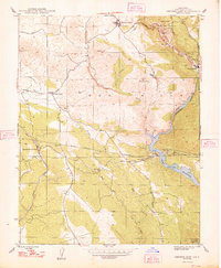
1948 Map of Chinese Camp
USGS Topo · Published 1948About this map
Gold-bearing hills and hydraulic mining scars dominate this landscape during the mid-twentieth century. The Red Hills rise above the Tuolumne River, which feeds into the Don Pedro Reservoir. Heavy industrial footprints from the Mother Lode's mining peak are still prominent, including the Eagle-Shawmut Mine and its accompanying Eagle-Shawmut Mill, alongside several other operations like the Tarantula Mine and Republican Mine. Extensive tailings deposits, including those at Six-bit Tailings, illustrate the massive displacement of earth used to extract precious metals.
Find a feature on this map
32 named features on this map. Tap any name to fly to it.
Don’t see what you’re looking for? This feature index may not catch every label — zoom into the map to look around manually.
Map Details
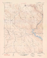
Editions of this 1948 Chinese Camp Map
2 editions found
Other maps of this area

1893 · Sonora
USGS Topo · 1:125,000

1896 · Sonora
USGS Topo · 1:125,000

1897 · Sonora
USGS Topo · 1:125,000

1898 · Sonora
USGS Topo · 1:125,000

1915 · La Grange
USGS Topo · 1:24,000

1916 · Cooperstown
USGS Topo · 1:31,680

1916 · Copperopolis
USGS Topo · 1:62,500

1919 · La Grange
USGS Topo · 1:31,680

1942 · Copperopolis
USGS Topo · 1:62,500

1944 · Merced Falls
USGS Topo · 1:62,500