
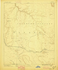
1886 Map of Chino
USGS Topo · Published 1886About this map
The Atlantic and Pacific R R provides the primary industrial artery across this section of the Colorado Plateau, linking isolated rail stops and water stations during the mid-1880s. This territorial landscape is defined by the vital necessity of water, evidenced by the distribution of Wagathile Tank, Kerlin Well, and the Davenport Tanks along the transport corridors. The map documents the overlap of traditional paths and modern infrastructure, where the historic Beale Wagon road traverses the high desert north of the emerging settlements of Williams and Ash Fork. Beyond the railroad towns, the terrain transitions into the steep Aubrey Cliffs and the broad Chino Valley, where the Garland Ranch represents early ranching efforts in the region. To the east, prominent landmarks like Bill Williams Mt 9264 and Mt Sitgreaves dominate the horizon, marking the high country of the Yavapai territory.
Find a feature on this map
39 named features on this map. Tap any name to fly to it.
Don’t see what you’re looking for? This feature index may not catch every label — zoom into the map to look around manually.
Map Details
Editions of this 1886 Chino Map
2 editions found
Other maps of this area

1886 · Diamond Creek
USGS Topo · 1:250,000

1886 · San Francisco Mtns
USGS Topo · 1:250,000

1886 · Mt. Trumbull
USGS Topo · 1:250,000

1886 · Echo Cliffs
USGS Topo · 1:250,000

1886 · Kaibab
USGS Topo · 1:250,000

1887 · Verde
USGS Topo · 1:250,000

1887 · Prescott
USGS Topo · 1:250,000

1891 · San Francisco Mtns
USGS Topo · 1:250,000

1891 · Chino
USGS Topo · 1:250,000

1891 · Echo Cliffs
USGS Topo · 1:250,000