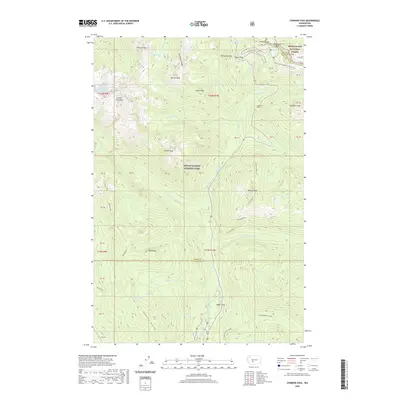
2020 Map of Chinook Pass
USGS Topo · Published 2020About this map
Mount Rainier National Park dominates the western portion of this high-altitude landscape, where the Cowlitz Divide and Governors Ridge meet. The area is defined by its extensive trail networks, most notably the Pacific Crest National Scenic Trail and the Wonderland Trail, which serve as the primary corridors through the alpine terrain. Strategic mountain crossings like Chinook Pass and Cayuse Pass provide the only vehicular access, linking the drainage basins of the Ohanapecosh River and Chinook Cr. Historically significant points such as Cedar Flats and the Tunnel on WA-123 reflect the engineering required to navigate this portion of the Snoqualmie National Forest. Numerous water features, including Saint Johns Falls, Silver Falls, and the high-elevation Owhigh Lakes, emphasize the glacial and volcanic hydrology of the Pierce and Yakima county border.
Find a feature on this map
66 named features on this map. Tap any name to fly to it.
Don’t see what you’re looking for? This feature index may not catch every label — zoom into the map to look around manually.
Map Details
Editions of this 2020 Chinook Pass Map
This is the sole edition of this map. No revisions or reprints were ever made.
Other maps of this area

1902 · Mount Aix
USGS Topo · 1:125,000

1904 · Mt Aix
USGS Topo · 1:125,000

1924 · Mt Rainier
USGS Topo · 1:96,000

1928 · Mt Rainier
USGS Topo · 1:125,000

1950 · Yakima
USGS Topo · 1:250,000

1958 · Yakima
USGS Topo · 1:250,000

1961 · Yakima
USGS Topo · 1:250,000

1962 · Bumping Lake
USGS Topo · 1:62,500

1962 · White Pass
USGS Topo · 1:62,500

1962 · Packwood
USGS Topo · 1:62,500