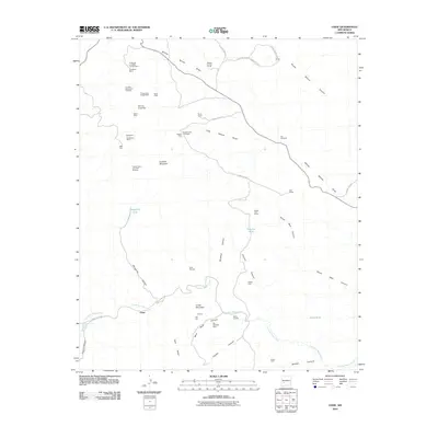
2010 Map of Chise
USGS Topo · Published 2010About this map
Sierra Cuchillo defines the western landscape of this Sierra County survey, which documents a complex history of resource extraction near the settlement of Chise. The map reveals a dense concentration of mining operations, ranging from the Confidence Mines and Vindicator Mine in the northwest to the Minita Mine in the southeast. This pattern of land use indicates a region shaped by prospecting, with labels like Prospectors Delight Mine and Denver Lode and Little Bonanza marking specific claims in the rugged foothills. Water management is critical in this arid environment, evidenced by named features such as Margarita Tank and Victoria Tank, alongside Fita Windmill. The inclusion of L C Ranch and Rouse Camp suggests the co-existence of ranching and mining economies, while the Chise Deposits and Mill Hill point to localized industrial processing. Topographic details trace the path of Cuchillo Negro Creek and numerous drainage patterns like Willow Spring Draw, providing an essential reference for understanding the physical constraints on local development.
Find a feature on this map
51 named features on this map. Tap any name to fly to it.
Don’t see what you’re looking for? This feature index may not catch every label — zoom into the map to look around manually.
Map Details
Editions of this 2010 Chise Map
This is the sole edition of this map. No revisions or reprints were ever made.
Other maps of this area

1954 · Tularosa
USGS Topo · 1:250,000

1958 · Tularosa
USGS Topo · 1:250,000

1961 · Priest Tank
USGS Topo · 1:24,000

1961 · Williamsburg NW
USGS Topo · 1:24,000

1961 · Monticello
USGS Topo · 1:24,000

1963 · Thumb Tank Peak
USGS Topo · 1:24,000

1963 · Sugarloaf Peak
USGS Topo · 1:24,000

1965 · Winston
USGS Topo · 1:24,000

1965 · Iron Mountain
USGS Topo · 1:24,000

1965 · Jaralosa Mountain
USGS Topo · 1:24,000