
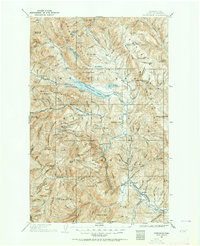
1901 Map of Chiwaukum
USGS Topo · Published 1956About this map
Leavenworth and Peshastin anchor the southeastern corner of this turn-of-the-century survey, positioned along the critical path of the Great Northern R.R.. The landscape is defined by the massive drainage systems of the Little Wenatchee River and White River feeding into the expansive Wenatchee Lake. Higher elevations reveal the dense network of the Wenatchee National Forest and the Chiwaukum Game Preserve, where alpine features like Loch Eileen and Lake Julius sit tucked beneath Nason Ridge. The early infrastructure of the region is evident in the presence of the Dardanelles P O and a Hatchery located near the junction of Chiwaukum Creek. This 1900-01 field study, updated with rail data through the mid-1950s, offers a detailed view of the mining and timber frontiers, specifically noting the Cashmere Min on the slopes of the Chiwaukum Mountains.
Find a feature on this map
117 named features on this map. Tap any name to fly to it.
Don’t see what you’re looking for? This feature index may not catch every label — zoom into the map to look around manually.
Map Details
Editions of this 1901 Chiwaukum Map
2 editions found
Other maps of this area

1897 · Mount Stuart
USGS Topo · 1:125,000

1899 · Glacier Peak
USGS Topo · 1:125,000

1899 · Methow
USGS Topo · 1:125,000

1901 · Glacier Peak
USGS Topo · 1:125,000

1901 · Chelan
USGS Topo · 1:125,000

1901 · Methow
USGS Topo · 1:125,000

1901 · Snoqualmie Pass
USGS Topo · 1:125,000

1902 · Skykomish
USGS Topo · 1:125,000

1902 · Mount Stuart
USGS Topo · 1:125,000

1902 · Stehekin
USGS Topo · 1:125,000