1968 Map of Chloride
USGS Topo · Published 1978About this map
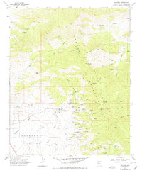
Chloride serves as the focal point of this late 1960s survey, situated at the base of the Cerbat Mountains. The settlement is surrounded by an incredibly dense concentration of mining claims, illustrating the intense silver and lead prospecting that defined this region of Mohave County. Significant workings such as the Tennessee Mine, Schuylkill Mine, and the Distaff Mine crowd the slopes of Silver Hill and the banks of Tennessee Wash. Evidence of much earlier inhabitants is also documented with the location of Petroglyphs marked along the mountain trails. To the west, the landscape opens into the broad Sacramento Valley, while the higher elevations provide for recreation at Packsaddle Campground and Windy Point Campground. This map provides a detailed record of the hard-rock mining infrastructure and the complex network of mountain roads connecting the Arizona Magma Mine and Payroll Mine to the town center.
Find a feature on this map
70 named features on this map. Tap any name to fly to it.
Don’t see what you’re looking for? This feature index may not catch every label — zoom into the map to look around manually.
Map Details
Editions of this 1968 Chloride Map
2 editions found
Other maps of this area

1886 · Camp Mohave
USGS Topo · 1:250,000

1892 · Camp Mohave
USGS Topo · 1:250,000
1939 · Chloride
USGS Topo · 1:48,000

1942 · Camp Mohave
USGS Topo · 1:250,000
1944 · Chloride
USGS Topo · 1:62,500

1947 · Kingman
USGS Topo · 1:250,000

1948 · Kingman
USGS Topo · 1:250,000

1954 · Kingman
USGS Topo · 1:250,000

1955 · Kingman
USGS Topo · 1:250,000

1958 · Kingman
USGS Topo · 1:250,000