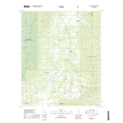
2018 Map of Choccolocco
USGS Topo · Published 2018About this map
Choccolocco Creek winds through a valley defined by significant topographic relief, where the Mountain Longleaf National Wildlife Refuge and Talladega National Forest meet. This terrain, characterized by heights such as Choccolocco Mtn and Horseblock Mtn, transitions into settled areas like Choccolocco and Iron City. Local history is preserved in small rural burial grounds, including Iron City Cem and Hanna Cem, which are scattered throughout the hills. The map illustrates a landscape of springs and small lakes, from Whitesides Mill Lake to Bonner Lake, which historically supported local industry. Long-established communities such as Old Davisville and DeArmanville are linked by a network of rural roads and forest trails like the Pinhoti NRT, reflecting the area's dual character as both a residential corridor and a protected wilderness area along the Calhoun County and Cleburne County line.
Find a feature on this map
147 named features on this map. Tap any name to fly to it.
Don’t see what you’re looking for? This feature index may not catch every label — zoom into the map to look around manually.
Map Details
Editions of this 2018 Choccolocco Map
This is the sole edition of this map. No revisions or reprints were ever made.
Other maps of this area

1900 · Anniston
USGS Topo · 1:125,000

1947 · Oxford
USGS Topo · 1:24,000

1947 · Anniston
USGS Topo · 1:24,000

1947 · Jacksonville
USGS Topo · 1:24,000

1947 · Jacksonville
USGS Topo · 1:62,500

1950 · Anniston
USGS Topo · 1:62,500

1953 · Atlanta
USGS Topo · 1:250,000

1954 · Choccolocco
USGS Topo · 1:24,000

1956 · Oxford
USGS Topo · 1:24,000

1956 · Anniston
USGS Topo · 1:24,000