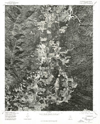
1975 Map of Choccolocco
USGS Topo · Published 1977About this map
Choccolocco Creek winds through the central valley of this 1970s orthophotoquad, providing a distinct overhead view of the agricultural and residential patterns in Calhoun County. The aerial photography reveals the specific layout of several communities, including Choccolocco and Iron City, where small clusters of buildings follow the local road network and the creek's path. Further north, the settlement of White Plains anchors the upper valley, while De Armanville sits near the southwestern edge. Unlike a standard topographic map, this imagery records the actual land use and forest cover as they existed in late 1975, offering a precise visual baseline for identifying family farmsteads and the evolution of these unincorporated communities before late-century development.
Find a feature on this map
5 named features on this map. Tap any name to fly to it.
Don’t see what you’re looking for? This feature index may not catch every label — zoom into the map to look around manually.
Map Details
Editions of this 1975 Choccolocco Map
This is the sole edition of this map. No revisions or reprints were ever made.
Other maps of this area

1900 · Anniston
USGS Topo · 1:125,000

1947 · Oxford
USGS Topo · 1:24,000

1947 · Anniston
USGS Topo · 1:24,000

1947 · Jacksonville
USGS Topo · 1:24,000

1947 · Jacksonville
USGS Topo · 1:62,500

1950 · Anniston
USGS Topo · 1:62,500

1953 · Atlanta
USGS Topo · 1:250,000

1954 · Choccolocco
USGS Topo · 1:24,000

1956 · Oxford
USGS Topo · 1:24,000

1956 · Anniston
USGS Topo · 1:24,000