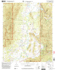
2001 Map of Choccolocco
USGS Topo · Published 2004About this map
Mountain Longleaf National Wildlife Refuge and the Choccolocco State Forest dominate this landscape on the border of Calhoun and Cleburne counties. The terrain is defined by a series of prominent ridges, including Rattlesnake Mtn and Horseblock Mountain, which frame the central valley of Choccolocco Creek. This 2001 revision of earlier 1950s data reveals a mix of timber management and small rural communities. Local history is anchored by sites like Whitesides Mill and Chosea Springs, while the spiritual life of the area is mapped through locations such as Pleasant Ridge Ch and Antioch Ch. The map captures the interface between protected forest land and the steady development near Choccolocco and White Plains.
Find a feature on this map
53 named features on this map. Tap any name to fly to it.
Don’t see what you’re looking for? This feature index may not catch every label — zoom into the map to look around manually.
Map Details
Editions of this 2001 Choccolocco Map
This is the sole edition of this map. No revisions or reprints were ever made.
Other maps of this area

1900 · Anniston
USGS Topo · 1:125,000

1947 · Oxford
USGS Topo · 1:24,000

1947 · Anniston
USGS Topo · 1:24,000

1947 · Jacksonville
USGS Topo · 1:24,000

1947 · Jacksonville
USGS Topo · 1:62,500

1950 · Anniston
USGS Topo · 1:62,500

1953 · Atlanta
USGS Topo · 1:250,000

1954 · Choccolocco
USGS Topo · 1:24,000

1956 · Oxford
USGS Topo · 1:24,000

1956 · Anniston
USGS Topo · 1:24,000