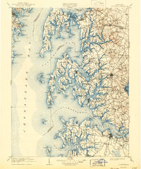
1908 Map of Choptank
USGS Topo · Published 1943About this map
Annapolis and the U.S. Naval Academy anchor the western shore of the Chesapeake Bay in this turn-of-the-century coastal survey. Across the water, the landscape of Maryland’s Eastern Shore is defined by an intricate network of tidal rivers, including the Choptank River, Wye River, and Miles River. The region’s economic lifeblood is clearly visible through its transition from water to rail, with lines like the Baltimore Chesapeake and Atlantic RR and the Queen Annes and Virginia RR connecting interior hubs like Easton and Queenstown to important shipping points.
Find a feature on this map
164 named features on this map. Tap any name to fly to it.
Don’t see what you’re looking for? This feature index may not catch every label — zoom into the map to look around manually.
Map Details
Editions of this 1908 Choptank Map
5 editions found

Other maps of this area

1892 · Leonardtown
USGS Topo · 1:62,500

1892 · Drum Point
USGS Topo · 1:62,500

1892 · Prince Frederick
USGS Topo · 1:62,500

1892 · Owensville
USGS Topo · 1:62,500

1892 · Annapolis
USGS Topo · 1:62,500

1893 · Sharps Island
USGS Topo · 1:62,500

1893 · North Point
USGS Topo · 1:62,500

1894 · Relay
USGS Topo · 1:62,500

1895 · Prince Frederick
USGS Topo · 1:62,500

1895 · Leonardtown
USGS Topo · 1:62,500