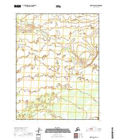
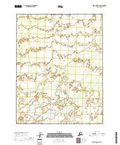
2018 Map of Christian A-2 SW
USGS Topo · Published 2018About this map
Hydrological patterns and remote terrain define this section of the Yukon-Koyukuk Census Area. The landscape is primarily organized by the Public Land Survey System, with township boundaries such as T27n R13e and T26n R13e providing the primary geographical framework. While specific settlement names are absent, the map reveals a complex network of wetlands and water bodies that dictate the character of the region. This 2018 survey uses data from the National Hydrography Dataset and SPOT imagery to document the natural drainage across T27n R12e and southward into T25n R13e. For researchers, the value lies in the precise contouring and elevation data from the National Elevation Dataset, which illustrates the subtle topography of this interior Alaskan wilderness before further environmental shifts occur.
Find a feature on this map
8 named features on this map. Tap any name to fly to it.
Don’t see what you’re looking for? This feature index may not catch every label — zoom into the map to look around manually.
Map Details
Editions of this 2018 Christian A-2 SW Map
This is the sole edition of this map. No revisions or reprints were ever made.
Other maps of this area

1951 · Fort Yukon
USGS Topo · 1:250,000

1951 · Christian
USGS Topo · 1:250,000

1955 · Fort Yukon D-2
USGS Topo · 1:63,360

1955 · Fort Yukon D-3
USGS Topo · 1:63,360

1956 · Christian
USGS Topo · 1:250,000

1956 · Fort Yukon
USGS Topo · 1:250,000
1956 · Fort Yukon D-3
USGS Topo · 1:63,360
1990 · Christian A-3
USGS Topo · 1:63,360
1990 · Christian A-2
USGS Topo · 1:63,360
2018 · Fort Yukon D-3 NE
USGS Topo · 1:25,000