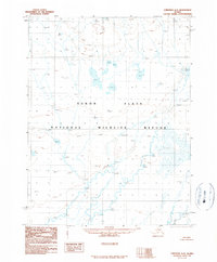
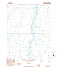
1990 Map of Christian A-2
USGS Topo · Published 1990About this map
Yukon Flats dominates the landscape in this interior Alaskan wilderness, as seen through photography from 1978 and 1981. The map depicts a complex hydrological network within the Yukon Flats National Wildlife Refuge, where numerous unnamed water bodies are identified only by their surface elevations, such as Wl 982t in the north and Wl 529t in the south. The terrain is characterized by meandering watercourses and expansive wetlands, typical of this subarctic basin. This 1990 provisional sheet highlights the intricate drainage patterns of the region, featuring specific points like Wl 696t and Wl 708t that illustrate the minimal vertical relief across the flats. The survey serves as a fundamental record of this remote ecosystem before further modern changes, focused entirely on the natural features and topographic elevations of the wilderness.
Find a feature on this map
24 named features on this map. Tap any name to fly to it.
Don’t see what you’re looking for? This feature index may not catch every label — zoom into the map to look around manually.
Map Details
Editions of this 1990 Christian A-2 Map
This is the sole edition of this map. No revisions or reprints were ever made.
Other maps of this area

1951 · Fort Yukon
USGS Topo · 1:250,000

1951 · Christian
USGS Topo · 1:250,000

1955 · Fort Yukon D-2
USGS Topo · 1:63,360

1955 · Fort Yukon D-3
USGS Topo · 1:63,360
1956 · Fort Yukon D-1
USGS Topo · 1:63,360

1956 · Christian
USGS Topo · 1:250,000

1956 · Fort Yukon
USGS Topo · 1:250,000
1956 · Fort Yukon D-3
USGS Topo · 1:63,360
1990 · Christian B-3
USGS Topo · 1:63,360
1990 · Christian A-1
USGS Topo · 1:63,360