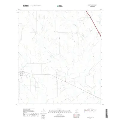
2019 Map of Christine East
USGS Topo · Published 2019About this map
Christine occupies the southwestern corner of this Atascosa County landscape, showing a grid of streets such as 13th St and G Ave that transition quickly into the open rangeland of south Texas. The area is defined by a dendritic network of ephemeral waterways, primarily Metate Cr and its tributaries like E Metate Cr and Salt Br, which carve shallow depressions across the terrain. Small, isolated bodies of water including McLerran Lake and Brown Lake dot the ranchlands, providing vital catchments in this semi-arid environment.
Find a feature on this map
36 named features on this map. Tap any name to fly to it.
Don’t see what you’re looking for? This feature index may not catch every label — zoom into the map to look around manually.
Map Details
Editions of this 2019 Christine East Map
This is the sole edition of this map. No revisions or reprints were ever made.
Other maps of this area

1930 · Whitsett
USGS Topo · 1:62,500

1942 · Whitsett
USGS Topo · 1:62,500

1953 · Crystal City
USGS Topo · 1:250,000

1955 · Crystal City
USGS Topo · 1:250,000

1956 · Pleasanton
USGS Topo · 1:62,500

1956 · Jourdanton
USGS Topo · 1:62,500

1956 · Franklin Settlement
USGS Topo · 1:62,500

1961 · Crystal City
USGS Topo · 1:250,000
1965 · Caballos Creek
USGS Topo · 1:24,000
1965 · Whitsett
USGS Topo · 1:24,000