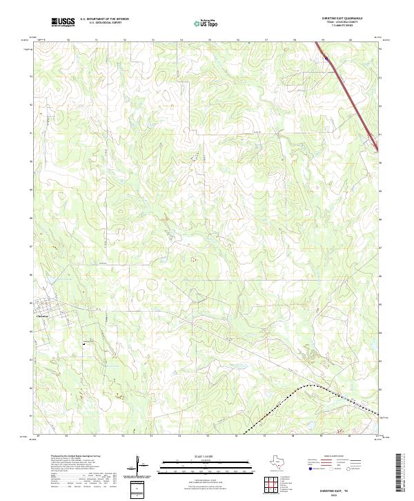
2022 Map of Christine East
USGS Topo · Published 2022About this map
Christine occupies the southwestern corner of this survey, organized by a distinct grid including 13th St and 16th St south of FM 140. The landscape of southern Texas here is defined by a dense network of intermittent waterways that drain toward the southeast, most notably Metate Cr and its tributary E Metate Cr. These drainages create a complex series of low ridges and shallow basins across the quadrangle, punctuated by small bodies of water like McLerran Lake and Brown Lake.
Find a feature on this map
29 named features on this map. Tap any name to fly to it.
Don’t see what you’re looking for? This feature index may not catch every label — zoom into the map to look around manually.
Map Details
Editions of this 2022 Christine East Map
This is the sole edition of this map. No revisions or reprints were ever made.
Other maps of this area

1930 · Whitsett
USGS Topo · 1:62,500

1942 · Whitsett
USGS Topo · 1:62,500

1953 · Crystal City
USGS Topo · 1:250,000

1955 · Crystal City
USGS Topo · 1:250,000

1956 · Pleasanton
USGS Topo · 1:62,500

1956 · Jourdanton
USGS Topo · 1:62,500

1956 · Franklin Settlement
USGS Topo · 1:62,500

1961 · Crystal City
USGS Topo · 1:250,000
1965 · Caballos Creek
USGS Topo · 1:24,000
1965 · Whitsett
USGS Topo · 1:24,000