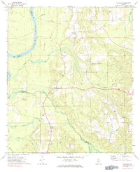
1972 Map of Chrysler
USGS Topo · Published 1984About this map
The Alabama River defines the western edge of this landscape, its winding course marked by Mt Pleasant Landing and the convergence of several major tributaries. Inland, the settlements of Chrysler, Eliska, and Mineola form a rural network connected by small family-named landmarks and local congregations. Genealogists will find notable burial and worship sites, including the Shomo Cem, Mamies Chapel, and Eliska Ch.
Find a feature on this map
36 named features on this map. Tap any name to fly to it.
Don’t see what you’re looking for? This feature index may not catch every label — zoom into the map to look around manually.
Map Details
Editions of this 1972 Chrysler Map
2 editions found
Other maps of this area

1942 · Perdido
USGS Topo · 1:62,500

1943 · Choctaw Bluff
USGS Topo · 1:62,500

1943 · Tensaw
USGS Topo · 1:62,500

1944 · Tensaw
USGS Topo · 1:62,500

1944 · Perdido
USGS Topo · 1:62,500

1946 · Choctaw Bluff
USGS Topo · 1:62,500

1953 · Andalusia
USGS Topo · 1:250,000

1957 · Andalusia
USGS Topo · 1:250,000

1972 · Chrysler
USGS Topo · 1:24,000

1972 · Uriah West
USGS Topo · 1:24,000