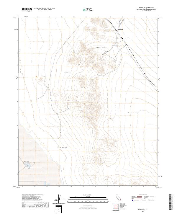
2021 Map of Chubbuck
USGS Topo · Published 2021About this map
Chubbuck sits at a remote desert junction where the Mojave Desert meets the expansive Ward Valley. This 2021 survey illustrates a landscape of extreme isolation, dominated by the central ridge of the Kilbeck Hills. The area is defined by its transit history and desert geology, with Cadiz Rd cutting through the valley floor toward the southern Cadiz Valley. The naming of Old Woman Meteorite Rd and Skeleton Pass Rd in the north suggests the region's harsh environmental character and local landmarks. To the west, the Salt Evaporation Plan Rd indicates the industrial footprint of saline extraction, a common economic driver in these arid basins. The map provides a contemporary view of these traditional desert transit corridors and the sparsely developed townships that once anchored them.
Find a feature on this map
14 named features on this map. Tap any name to fly to it.
Don’t see what you’re looking for? This feature index may not catch every label — zoom into the map to look around manually.
Map Details
Editions of this 2021 Chubbuck Map
This is the sole edition of this map. No revisions or reprints were ever made.
Other maps of this area

1942 · Amboy
USGS Topo · 1:250,000

1943 · Amboy
USGS Topo · 1:250,000

1943 · Cadiz Lake
USGS Topo · 1:62,500

1943 · Cadiz Valley
USGS Topo · 1:62,500

1943 · Iron Mountains
USGS Topo · 1:62,500

1954 · Needles
USGS Topo · 1:250,000

1956 · Needles
USGS Topo · 1:250,000

1956 · Milligan
USGS Topo · 1:62,500

1956 · Iron Mountains
USGS Topo · 1:62,500

1956 · Cadiz Lake
USGS Topo · 1:62,500