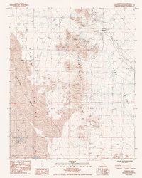
1985 Map of Chubbuck
USGS Topo · Published 1985About this map
The remote desert settlement of Chubbuck and its associated Ruins sit at the intersection of industry and isolation in this mid-1980s landscape. Located along the At&Sf rail line, the area is defined by a heavy mining presence, ranging from unnamed Mines and Prospects to the New Frontier Mine within the Kilbeck Hills. To the south, the dry expanse of Cadiz Lake is utilized for its mineral resources, evidenced by the presence of Salt Evaporators. The terrain is a stark contrast between the high relief of Desert Butte and the shifting Sand Dunes of the Cadiz Valley. This map documents a period when the infrastructure for large-scale evaporative salt harvesting and hard-rock prospecting shaped the sparse human footprint in the Mojave.
Find a feature on this map
20 named features on this map. Tap any name to fly to it.
Don’t see what you’re looking for? This feature index may not catch every label — zoom into the map to look around manually.
Map Details
Editions of this 1985 Chubbuck Map
This is the sole edition of this map. No revisions or reprints were ever made.
Other maps of this area

1942 · Amboy
USGS Topo · 1:250,000

1943 · Amboy
USGS Topo · 1:250,000

1943 · Cadiz Lake
USGS Topo · 1:62,500

1943 · Cadiz Valley
USGS Topo · 1:62,500

1943 · Iron Mountains
USGS Topo · 1:62,500

1954 · Needles
USGS Topo · 1:250,000

1956 · Needles
USGS Topo · 1:250,000

1956 · Milligan
USGS Topo · 1:62,500

1956 · Iron Mountains
USGS Topo · 1:62,500

1956 · Cadiz Lake
USGS Topo · 1:62,500