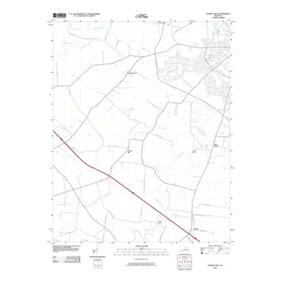
2010 Map of Church Hill
USGS Topo · Published 2010About this map
Church Hill serves as a central anchor in this Christian County landscape, where the meandering course of the Little River and its numerous tributaries dictate the local geography. The map reveals a transition from traditional rural settlement patterns to modern suburban growth, particularly evident near West Brook and along Eagle Way. The naming of local infrastructure, such as Striped Bridge and Swift Ford Rd, points to long-standing river crossings that have historically connected the small communities of Beverly, Merrittstown, and Cedar Bluff. The presence of Sinking Fork and Riverside Creek further defines the watershed, illustrating the complex drainage system that has influenced land use and property boundaries in this part of Kentucky for generations.
Find a feature on this map
38 named features on this map. Tap any name to fly to it.
Don’t see what you’re looking for? This feature index may not catch every label — zoom into the map to look around manually.
Map Details
Editions of this 2010 Church Hill Map
This is the sole edition of this map. No revisions or reprints were ever made.
Other maps of this area

1944 · Clarksville
USGS Topo · 1:50,000

1950 · Caledonia
USGS Topo · 1:24,000

1951 · Church Hill
USGS Topo · 1:24,000

1951 · Caledonia
USGS Topo · 1:24,000

1951 · Hopkinsville
USGS Topo · 1:24,000

1951 · Roaring Spring
USGS Topo · 1:24,000

1951 · Herndon
USGS Topo · 1:24,000

1951 · Oak Grove
USGS Topo · 1:24,000

1952 · Pleasant Green Hill
USGS Topo · 1:24,000

1952 · Kelly
USGS Topo · 1:24,000