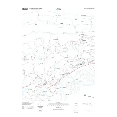
2013 Map of Church Hill
USGS Topo · Published 2013About this map
Church Hill and Mount Carmel anchor this 2013 survey of the Holston River valley, where the suburban growth of the Kingsport area meets the long-standing agricultural and transport corridors of Sullivan County. The map documents a landscape defined by parallel ridges like Pine Ridge and Brushy Ridge, with the Cherokee Lake impoundment creating a complex shoreline at Solitude Bend and McPheeter Bend. Historical infrastructure remains visible through features such as the Sensabaugh Tunnel and the site of Hord Mill along Hord Cr, while the inclusion of Ross Campground and several neighborhood springs like Union Spring and Clear Spring points to the area's social and natural history. This edition provides a precise view of the local aviation footprint at Darnell's Field Airport and Darnell's Landings Airport, positioned along the river flats south of the main settlements.
Find a feature on this map
247 named features on this map. Tap any name to fly to it.
Don’t see what you’re looking for? This feature index may not catch every label — zoom into the map to look around manually.
Map Details
Editions of this 2013 Church Hill Map
This is the sole edition of this map. No revisions or reprints were ever made.
Other maps of this area

1892 · Greeneville
USGS Topo · 1:125,000

1894 · Estillville
USGS Topo · 1:125,000

1896 · Greeneville
USGS Topo · 1:125,000

1904 · Greeneville
USGS Topo · 1:125,000

1935 · Surgoinsville
USGS Topo · 1:48,000

1935 · Lovelace
USGS Topo · 1:24,000

1935 · Sullivan Gardens
USGS Topo · 1:24,000

1935 · Moggasin
USGS Topo · 1:48,000

1935 · Kingsport
USGS Topo · 1:24,000

1935 · Clinchport
USGS Topo · 1:24,000