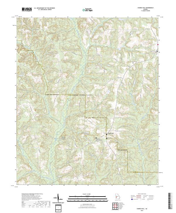
2024 Map of Church Hill
USGS Topo · Published 2024About this map
Kinchafoonee Creek and Lannahassee Creek wind through the borderlands of Marion and Webster Counties, creating a landscape defined by its riparian networks and quiet rural crossroads. The settlement of Church Hill serves as a local anchor in the southeast, surrounded by several historically significant religious and burial sites. The presence of Evans Chapel Christian Methodist Episcopal Church, Smyrna Cem, and Shiloh Cem within a small radius suggests a long-standing community structure where family and faith were centered near the county line.
Find a feature on this map
51 named features on this map. Tap any name to fly to it.
Don’t see what you’re looking for? This feature index may not catch every label — zoom into the map to look around manually.
Map Details
Editions of this 2024 Church Hill Map
This is the sole edition of this map. No revisions or reprints were ever made.
Other maps of this area

1949 · Glen Alta
USGS Topo · 1:24,000

1950 · Buena Vista
USGS Topo · 1:24,000

1950 · Buena Vista
USGS Topo · 1:62,500

1955 · Buena Vista
USGS Topo · 1:24,000
1955 · Glen Alta
USGS Topo · 1:24,000
1955 · Buena Vista
USGS Topo · 1:62,500

1955 · Phenix City
USGS Topo · 1:250,000

1957 · Phenix City
USGS Topo · 1:250,000

1958 · Phenix City
USGS Topo · 1:250,000

1971 · Tazewell South
USGS Topo · 1:24,000