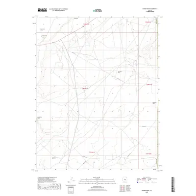
2018 Map of Church Rock
USGS Topo · Published 2018About this map
Church Rock stands as a prominent landmark overlooking the expansive Church Rock Valley in this Navajo County landscape. The area is characterized by several large geological features, including the elevated Baby Rocks Mesa and Red Point Mesa, which define the local horizon. The map details a network of arterial roads managed by the Bureau of Indian Affairs, such as Indian Rte 18 and Indian Rte 57, which serve this region within the Navajo Nation. To the south, the terrain levels out at the Small White Mesa Flat before reaching the drainage of Tyende Cr. This 2018 survey provides a clear view of the modern infrastructure and natural landmarks, such as Gray Point and Facing Red Points, illustrating how traditional landforms continue to serve as the primary points of reference in this part of Arizona.
Find a feature on this map
19 named features on this map. Tap any name to fly to it.
Don’t see what you’re looking for? This feature index may not catch every label — zoom into the map to look around manually.
Map Details
Editions of this 2018 Church Rock Map
This is the sole edition of this map. No revisions or reprints were ever made.
Other maps of this area

1883 · Marsh Pass
USGS Topo · 1:250,000

1892 · Marsh Pass
USGS Topo · 1:250,000

1892 · Canyon De Chelly
USGS Topo · 1:250,000

1952 · Dinnehotso
USGS Topo · 1:62,500

1952 · Agathla Peak 1 SE
USGS Topo · 1:24,000

1952 · Setsiltso Springs 2 SW
USGS Topo · 1:24,000

1952 · Agathla Peak
USGS Topo · 1:62,500

1952 · Agathla Peak 1 SW
USGS Topo · 1:24,000

1954 · Shiprock
USGS Topo · 1:250,000

1956 · Marble Canyon
USGS Topo · 1:250,000