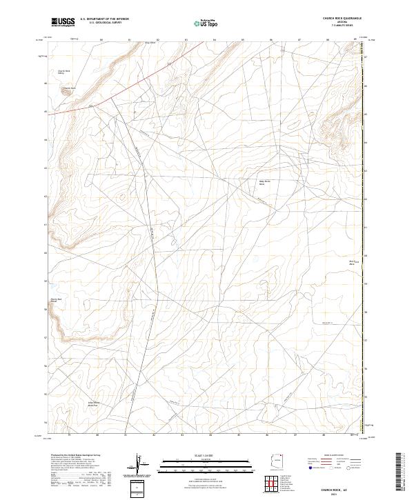
2021 Map of Church Rock
USGS Topo · Published 2021About this map
Church Rock stands as a prominent landmark in the high desert of the Navajo County region, anchoring a landscape defined by dramatic sandstone formations and high plateaus. This 2021 survey documents the remote terrain of the Navajo Nation, where travel is dictated by a network of regional corridors including Indian Rte 18, Indian Rte 59, and Indian Rte 57. The map illustrates a world of vast open spaces between significant elevations like Baby Rocks Mesa and the lower stretches of Church Rock Valley. These named topographical features, such as Facing Red Points and Small White Mesa Flat, represent a geography where every rise and fall in the land has a distinct identity in an area otherwise characterized by its isolation and sparse infrastructure.
Find a feature on this map
20 named features on this map. Tap any name to fly to it.
Don’t see what you’re looking for? This feature index may not catch every label — zoom into the map to look around manually.
Map Details
Editions of this 2021 Church Rock Map
This is the sole edition of this map. No revisions or reprints were ever made.
Other maps of this area

1883 · Marsh Pass
USGS Topo · 1:250,000

1892 · Marsh Pass
USGS Topo · 1:250,000

1892 · Canyon De Chelly
USGS Topo · 1:250,000

1952 · Dinnehotso
USGS Topo · 1:62,500

1952 · Agathla Peak 1 SE
USGS Topo · 1:24,000

1952 · Setsiltso Springs 2 SW
USGS Topo · 1:24,000

1952 · Agathla Peak
USGS Topo · 1:62,500

1952 · Agathla Peak 1 SW
USGS Topo · 1:24,000

1954 · Shiprock
USGS Topo · 1:250,000

1956 · Marble Canyon
USGS Topo · 1:250,000