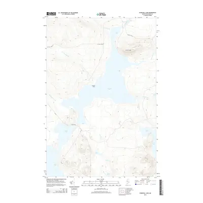
2014 Map of Churchill Lake
USGS Topo · Published 2014About this map
Johns Bridge spans the connection between major water bodies in this remote northern Maine wilderness, a critical crossing point for the logging roads that penetrate the dense forest. The landscape is dominated by the massive Churchill Lake and Eagle Lake, part of the historic Allagash wilderness waterway. The Allagash River flows north from Heron Lake through Chase Rapids, marking a traditional route for timber transport and backcountry travel. Low-lying wetlands and smaller bodies of water like Twin Lake and Otter Pond are tucked between elevations such as Churchill Ridge. The sparse road network, including Churchill Dam Rd and Cyr Rd, follows the contours of the brook valleys, supporting the regional timber industry and providing access to the numerous ponds and streams that define this drainage basin.
Find a feature on this map
24 named features on this map. Tap any name to fly to it.
Don’t see what you’re looking for? This feature index may not catch every label — zoom into the map to look around manually.
Map Details
Editions of this 2014 Churchill Lake Map
This is the sole edition of this map. No revisions or reprints were ever made.
Other maps of this area

1932 · Umsaskis Lake
USGS Topo · 1:48,000

1932 · Musquacook Lakes
USGS Topo · 1:48,000

1935 · Umsaskis Lake
USGS Topo · 1:62,500

1935 · Musquacook Lakes
USGS Topo · 1:62,500

1954 · Spider Lake
USGS Topo · 1:62,500

1954 · Churchill Lake
USGS Topo · 1:62,500

1954 · Presque Isle
USGS Topo · 1:250,000

1958 · Presque Isle
USGS Topo · 1:250,000

1960 · Presque Isle
USGS Topo · 1:250,000

1961 · Spider Lake
USGS Topo · 1:62,500