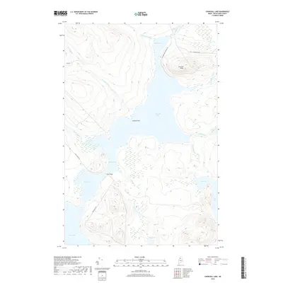
2018 Map of Churchill Lake
USGS Topo · Published 2018About this map
Churchill Lake dominates this northern Piscataquis County landscape, serving as a central hub for the intricate waterways of the North Maine Woods. The map details the connection between several major water bodies, including Heron Lake, Round Pond, and the northern reaches of Eagle Lake. This aquatic network is joined by the Thoroughfare, where Johns Bridge provides a vital crossing point for the remote timberlands and recreational access. To the north, the Allagash River flows toward Chase Rapids, illustrating the transition from still lake waters to the more dynamic river segments of this protected corridor.
Find a feature on this map
25 named features on this map. Tap any name to fly to it.
Don’t see what you’re looking for? This feature index may not catch every label — zoom into the map to look around manually.
Map Details
Editions of this 2018 Churchill Lake Map
This is the sole edition of this map. No revisions or reprints were ever made.
Other maps of this area

1932 · Umsaskis Lake
USGS Topo · 1:48,000

1932 · Musquacook Lakes
USGS Topo · 1:48,000

1935 · Umsaskis Lake
USGS Topo · 1:62,500

1935 · Musquacook Lakes
USGS Topo · 1:62,500

1954 · Spider Lake
USGS Topo · 1:62,500

1954 · Churchill Lake
USGS Topo · 1:62,500

1954 · Presque Isle
USGS Topo · 1:250,000

1958 · Presque Isle
USGS Topo · 1:250,000

1960 · Presque Isle
USGS Topo · 1:250,000

1961 · Spider Lake
USGS Topo · 1:62,500